Introduction
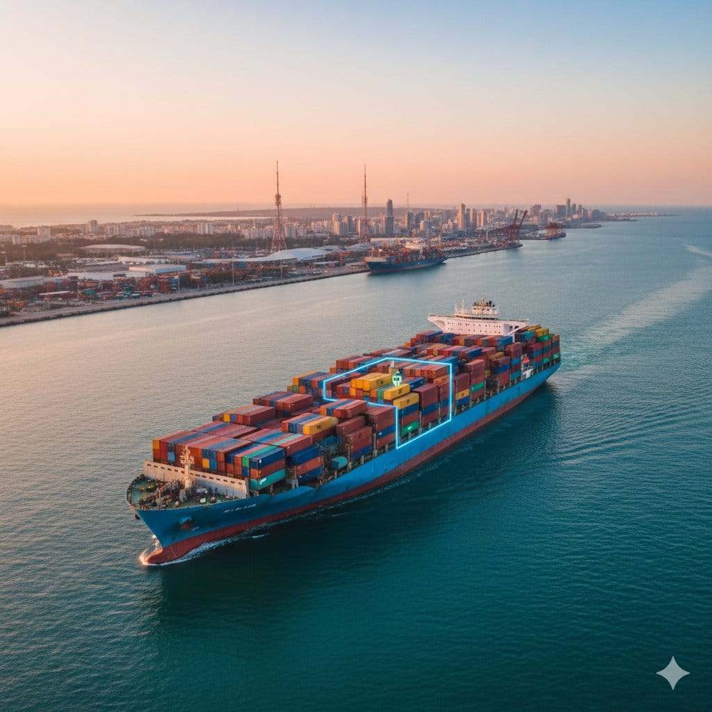
Tracking the location and condition of ocean freight containers in real time has traditionally been challenging and expensive. Cargo ships spend weeks in transit with little or no cellular coverage, making continuous reporting difficult without costly satellite communication. However, recent advances in IoT tracking devices and smart data logging have enabled a satellite-free container tracking system for ocean freight. This approach uses GNSS-based location logging on the device, local storage of events, and cellular data upload when a ship nears the coast, with an optional satellite uplink as a backup for high-value cargo. The result is a solution that provides end-to-end visibility and condition monitoring of containers without relying on constant satellite communication.
In an era of massive shipping delays, piracy risks, and heightened consumer interest in shipment tracking, shippers need robust yet cost-effective ways to monitor cargo. By leveraging devices like Eelink's GPT29, GPT50, and TPT02 trackers – which combine GPS/GNSS sensors, environmental monitors, and intelligent power management – logistics providers can achieve continuous oversight of shipments while preserving battery life and data integrity. This article explains the design and architecture of such a system, and how to deploy it in practice for reliable ocean freight tracking without satellites.
Key Benefits of a Satellite-Free Tracking Solution:
Data Integrity & Auditability: All location and sensor data is recorded on the device and later uploaded to the cloud, ensuring a complete, gap-free history of the container's journey. Shippers and customers can audit the shipment's condition from origin to destination with confidence in the data's accuracy and completeness.
Battery Longevity: By avoiding power-hungry satellite transceivers and limiting real-time transmission to only when cellular signal is available, the device can operate for months or even years on a single battery charge. Intelligent duty cycling (sleep modes, infrequent GNSS fixes, etc.) allows multi-year battery life (5+ years in some cases) while still capturing all essential information.
Operational Visibility: Even without live mid-ocean updates, the system provides actionable visibility. As soon as a vessel comes within range of coastal cellular networks, all logged data – position tracks, temperature/humidity readings, door open/close events, shock alerts – are transmitted to the cloud and made available on tracking dashboards. Stakeholders get near-real-time updates during port calls and know exactly where the container has been and what conditions it experienced. Critical events can be flagged immediately upon upload, enabling timely responses (e.g. if a refrigerated container's temperature went out of range).
Cost-Effective Coverage: Cellular data transmission is far cheaper than satellite bandwidth. By confining high-volume data uploads to when a standard 4G/5G or LTE-M signal is available (typically within ~20 km of coast or at ports), operational costs drop dramatically. Optional satellite backup can be reserved for exception-based alerts or high-value cargo only, balancing cost with risk.
Ruggedness & Compliance: Modern container trackers like the Eelink GPT29 are built to endure harsh intermodal conditions – from ocean salt spray to impacts. Devices are typically waterproof (IP67/IP68) and shock-resistant, with 3-axis accelerometers to detect drops and vibrations above thresholds. They carry international certifications (FCC, CE, etc.) and even FAA compliance for safe use in air freight, meaning they can travel with the container across sea, road, or air legs of the journey seamlessly.
With these benefits in mind, we now delve into the technical design of the solution – from the device hardware and on-container logic, to the communication architecture and cloud platform. We also discuss practical deployment considerations, sample configurations (GNSS logging intervals, event triggers, upload logic), a three-layer protection model for data continuity, and a two-tier transmission model that distinguishes between purely cellular tracking and satellite-augmented tracking.
Device Layer: On-Container Tracker Design and Logic
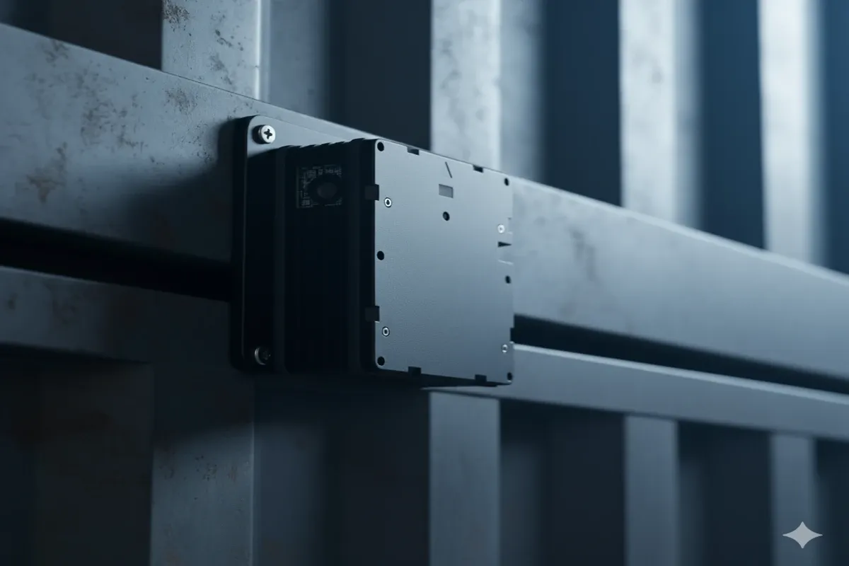
At the core of the system is a rugged container tracking device affixed to each shipping container. This device is responsible for collecting GNSS (GPS/GLONASS etc.) location fixes, monitoring environmental sensors, and logging events locally throughout the voyage. The hardware is purpose-built for long-term autonomous operation:
Rugged Hardware & Sensors: The tracker is encased in a durable, waterproof housing (typically IP66/IP67 rated or better) to survive rain, sea spray, and dust. For example, the Eelink GPT29 device is IP67 waterproof and includes built-in motion and light sensors, plus temperature and humidity monitors. These sensors provide a constant stream of data on the container's status – detecting events like door openings (via light sensor), sudden shocks or drops (via accelerometer), temperature/humidity changes, and more. High-end models like GPT29 leverage multi-sensor input to capture "everything about the container: location, temperature, elevation, shock, drop, humidity, moisture, and more." Such comprehensive sensing means
that any deviations (e.g. a temperature spike or an impact) are recorded for later review
GNSS-Based Location Logging: The device's GNSS receiver (GPS and often other constellations like GLONASS, BeiDou) is configured to obtain periodic location fixes. A configurable interval is used – for instance, a common setting might be to attempt a fix every 1 or 2 hours when in transit. The interval can be adjusted based on the desired track detail and battery considerations. In long-standby mode meant for maximizing battery life, a device might log just one location per day to confirm the container's daily position. In other profiles, it might log more frequently (e.g. every 30 minutes or when motion is detected) to provide a finer-grained route history. Each successful fix (latitude/longitude plus timestamp) is stored in the device's non-volatile memory. If the GNSS signal is unavailable (e.g. inside a ship's hold), the device may record the last known position or use other cues (some trackers can do coarse positioning via cellular LBS or Wi-Fi SSIDs if available). The goal at this layer is to continuously gather location data independently of connectivity – ensuring the path is documented even when offline.
Local Data Storage & Security: All sensor readings and events are time-stamped and saved to an onboard memory (flash storage). This local log functions as a black box for the journey – preserving data until it can be transmitted. Modern trackers can store thousands of entries; for example, storing one fix per hour for a 30-day voyage would only be ~720 entries, which is well within typical memory limits. The data is stored in a fail-safe manner to protect integrity: even if the device resets or the battery dies, non-volatile memory retains the log. Some devices may employ data encryption or authentication so that logs cannot be tampered with, supporting auditability. Audit trails of location and condition are thus sealed on the device, ready for upload when connection allows. As one user of Eelink's solution noted, "all the details, including location, condition and other necessary meta-data are stored in the cloud via the gateways, so there is no fear of losing the data". This confidence starts with robust on-device storage – no data is lost in transit, even if real-time feed is not available.
Power Management: The device layer also implements aggressive power management to achieve multi-month or multi-year battery life. This includes using high-capacity batteries and intelligent firmware. For example, Eelink's GPT50 tracker contains a 24,000 mAh lithium battery, enabling up to 5–8 years of operation in long-standby mode (reporting a location just once per day). To conserve energy, the device spends most of its time in a deep sleep state, waking at defined intervals or on important events. GNSS modules are duty-cycled (on only long enough to get a fix) and the cellular modem is powered down when out of network range to avoid draining power searching for signal. The device's motion sensor can wake the unit from sleep if it detects movement (e.g. container handling) or other triggers, and it can switch to a different mode if needed (more on modes shortly). By controlling sleep/wake times and using sensor-triggered wakeups, the device maximizes battery longevity. Users can typically configure these parameters – for instance, setting the tracker to enter an "Emergency Mode" with more frequent updates if certain conditions are met, versus a "Long Standby Mode" for normal cruising where power saving is prioritized.
One-Button Activation & Reusability: Many container trackers (like GPT29) feature one-button activation for simplicity. Before a container is dispatched, an operator can arm the device with a single press, initiating its tracking program. The device can be easily mounted on the container – often using magnetic mounts or industrial adhesive – and left for the duration of the trip. Because of the long battery life and rugged build, the same tracker can be reused across multiple shipments without recharge (in the case of non-rechargeable primary batteries) or with infrequent recharging cycles. This plug-and-play design makes deployment practical: there is no complex wiring or integration needed on the container. Simply attach the self-powered unit, turn it on, and it begins logging data. Some devices include tamper sensors (e.g., the GPT49 model has a tamper switch) so that if a unit is removed or opened, it records an alert. IP66/IP67 sealing and vibration-proof construction protect the device from the knocks and bangs of intermodal transport. Overall, the device layer is engineered to be install-and-forget, reliably recording data throughout the voyage with minimal human intervention.
Event Detection and Logging
In addition to periodic location logs, the device firmware monitors for event triggers that merit immediate logging (and possibly an urgent transmission, if a network is available or if using satellite backup). Key event types and their handling might include:
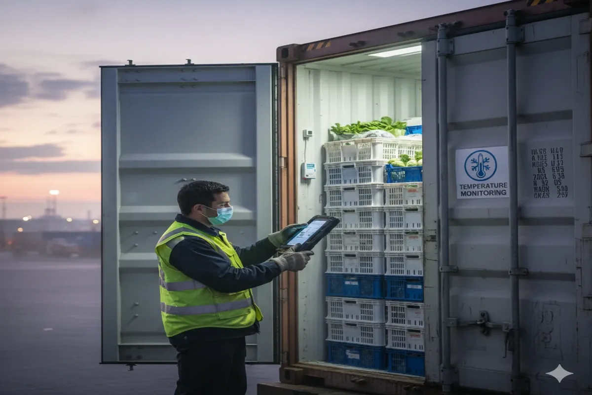
Door Open/Close: Detected via a light sensor or magnetic reed switch. For instance, Eelink's TPT02 tracker uses a light sensor to detect when a container door is opened, indicating a potential loading/unloading or unauthorized access. When triggered, the device records a "door open" event with timestamp (and might take a GPS fix to mark the location of the event). This is critical for security and chain-of-custody audits.
Shock & Vibration: A built-in accelerometer records any significant shock, drop, or excessive vibration. The GPT29, for example, can adjust to shock events and withstand drops above a threshold, logging an alert when such an event occurs. This helps identify if a container was dropped or impacted (which could damage contents). The event log might include metrics like G-force or a simple flag that a shock exceeded the safe limit.
Temperature/Humidity Excursions: For refrigerated or sensitive goods, temperature and humidity sensors continuously monitor the internal environment. If readings go outside of predefined safe ranges, the device logs an alarm event. TPT02 is explicitly designed for cold chain monitoring, with a high-precision temperature sensor feeding continuous data and near-real-time alerts to enable corrective action before spoilage.
Geofence Entry/Exit: The device's software can have geofences for key points (e.g. port areas). When a GNSS fix indicates that the container has entered or left a geofenced region (like departing the origin port, or arriving at a destination country's coastal area), the event is noted. This can later be used to automatically mark milestones in the trip timeline.
Low Battery: The device monitors its battery level. If the battery falls below certain thresholds, it logs a low-battery event. In some configurations, a low battery might also prompt more urgent action (e.g. attempt to send a last known position via any available network) to avoid losing the asset if the battery dies before retrieval.
Each of these events is prioritized in what we can call an event priority hierarchy. Critical events (such as door opens or high shock events) are marked with high priority. If a communication channel is available at the moment (say the ship is near shore or an optional satellite link is active), the device may attempt an immediate upload of high-priority alerts. If not, those events are flagged in memory for priority transmission once a connection is obtained. Less critical events (like routine temperature logs or periodic location pings) are stored and sent in batch during the next upload window. This hierarchy ensures that when bandwidth is limited (as it is during brief connectivity windows), the most important information is transferred first.
Coastal Upload Layer: Cellular Data Transmission and Recovery
The second layer of the system's architecture is the coastal upload layer, which handles communication between the container device and the cloud backend once the device is able to connect to terrestrial networks. During the long ocean voyage, the tracker may have virtually no connectivity (aside from optional satellite signals discussed later). But as the ship approaches land – typically within a few tens of kilometers of the shore – the device's cellular modem begins to detect networks and can establish a connection to upload the stored data.
Multi-Network Connectivity: To maximize the chance of a connection as early as possible, container trackers are designed with broad cellular network compatibility. For instance, the GPT29 supports 2G, 3G, 4G/LTE, and even LTE-M (Cat-M1) and NB-IoT networks. This means whether the nearest signal is an older GSM tower on a remote island or a modern LTE-M IoT network at a busy port, the device can latch onto it. The SIM card in the device is usually global-roaming or multi-carrier, allowing it to use local networks in whatever country or region the ship is approaching. As a vessel comes within range of coastal cell towers, the tracker periodically "listens" for network beacons. The device might wake more frequently to check for signal as it knows (via either a timer or possibly light sensor detecting daylight after a dark hold, etc.) that it should be nearing port. This is part of the logic: when out of coverage, check infrequently; when nearing expected coverage zones, check more often to ensure a timely connection.
Store-and-Forward Upload: Once a cellular link is established, the device moves into an upload mode. It will transmit the stored GNSS logs and event data to the cloud platform. Typically, data is uploaded in chronological order (with priority events first as mentioned). The transmission might occur via HTTP(S) API calls, MQTT messages, or a custom TCP/UDP protocol to the tracking server. Importantly, the device usually uses acknowledgments – it will keep data in memory until it is confirmed received by the server. This prevents data loss in case of an intermittent connection. If the connection drops (common if a ship only skirts the edge of coverage or during handoffs between cell towers), the device will retry until success. In practice, a large backlog of data (say two weeks of hourly logs) can be uploaded in a matter of seconds to minutes over a 4G connection, since the total size is small (a few kilobytes). Even on a 2G connection, the store-and-forward mechanism ensures all data trickles through eventually. This coastal upload process leverages the fact that ships often spend hours approaching ports (pilots boarding, etc.), giving ample time to offload data.
One can think of this layer as a data ferry – the data patiently waits on the device until the "ferry" (cellular link) comes into harbor, at which point all the accumulated information is offloaded to the cloud. This provides a second layer of protection in the system: even if the device had been isolated, the coastal network acts as the conduit to recover all stored information reliably. The phrase "three-layer protection" can thus be understood as: (1) device layer safeguards data locally, (2) coastal upload layer ferries data to cloud when possible, and (3) cloud layer (next section) provides oversight and inference. Each layer ensures that a break in one link (e.g. no network at sea) doesn't break the overall chain of information.
Data Integrity and Verification: During upload, the system often implements verification checks. The cloud platform might maintain counters of how many logs it expects (based on device's last known sequence, etc.) and confirm when all records are received. The device could also have an internal pointer of the last uploaded record, so it only sends new data beyond that on subsequent connections. This ensures no duplication and no gaps. In some setups, the device can compress data or batch multiple readings into one packet to optimize transmission. For example, uploading one packet containing 24 hourly readings is more efficient than 24 separate transmissions. All communication is typically encrypted (using TLS for HTTP/MQTT or AES for UDP) to protect data in transit.
Edge Processing & Event Alerts: The coastal connection is also an opportunity for the device to send any real-time alerts for events that might still be ongoing. For instance, if a container arrives at port and the temperature is out of range, the device can immediately transmit that fact so ground personnel can be alerted upon docking. Similarly, a "container has arrived at Port X" message might be triggered via geofence recognition as soon as a GPS fix confirms location near the port. Even without satellite communications, this near-immediate coastal alert can greatly enhance responsiveness – the data is essentially live once a ship hits cellular coverage. This meets many operational needs: for example, a consignee can be notified that "Container ABC123 has landed at Los Angeles port and here is its complete route and condition log."
It's worth noting that modern trackers may also leverage alternative wireless channels at ports if available. Some ports or ships have Wi-Fi networks; a device like GPT29 that has a Wi-Fi radio could potentially upload via a known Wi-Fi access point (for instance, if a shipping line equips vessels with Wi-Fi and grants the trackers access). Bluetooth (BLE) might also be used in some systems – e.g. a crew member could retrieve data by coming in range with a handheld reader. However, these are supplemental; the primary design is for autonomous cellular upload the moment a public network is available.
Example of Coastal Upload in Action
Consider a container ship approaching the Port of Rotterdam after a transatlantic voyage. Each container's tracker has been dutifully logging hourly GPS points and any events (no transmissions during the 5-day open ocean crossing). As the ship comes within ~15 km of the Dutch coastline, the tracker's SIM picks up a local LTE-M signal from a carrier. The device automatically registers on the network and establishes a data connection. Over the next few minutes, it uploads all saved data – perhaps 120 location points and 2-3 event flags recorded during the trip – to the cloud platform. The cloud acknowledges receipt and the device memory marks those logs as delivered. The device also captures the current position (offshore approach) and sends that as part of an "arrival approaching" event. By the time the ship actually docks, stakeholders have a full record of the crossing and know the container's latest position. If anything abnormal had occurred (say a temperature excursion mid-voyage), that information is now visible to the shippers and consignees, who can prepare accordingly (e.g., arrange inspection or expedited unloading for that container). All of this happened automatically and cost-efficiently via standard cellular data – no satellite fees incurred.
Cloud Inference Layer: Back-End Data Integration and Visibility
Once the data reaches the cloud, the third layer – the cloud inference layer – takes over. This layer encompasses the server infrastructure and software that aggregate the uploaded data, interpret it, and present it to users (via dashboards, alerts, or API feeds). It provides a central point of intelligence and integration, completing the end-to-end system.
Key functions of the cloud layer include:
Data Consolidation and Storage: The cloud platform receives transmissions from many container devices and stores each container's journey log in a database. All location points, sensor readings, and event flags are now consolidated in one timeline per container. This historical log is stored securely (often redundantly across servers for reliability). Because the data came from the device's secure logs, it is trustworthy and can serve as an immutable record of the shipment's history – useful for audits or compliance. For example, retailers can demand reports of a shipment's history from origin to destination, and the system can readily provide this from the stored data.
Visualization and Tracking Dashboard: The cloud software often includes mapping and analytics tools. Users can view the container's route plotted on a map, with indicators for each logged point. Even if the data was uploaded in batches, the platform can display it as a continuous trajectory. Gaps where no data was logged (if any) can be interpolated or highlighted. Real-time tracking is achieved whenever the container is in cellular coverage (e.g., near coasts or on land legs), and during ocean transit the platform might show the last known position and an estimated current position based on course and speed. When new data uploads, the map updates accordingly. In effect, shipping companies can see exactly where their cargo containers are in near-real-time and review conditions inside with a click – either live or retrospectively once data is received.
Alerts and Notifications: The cloud layer generates alerts for any out-of-tolerance events. If a temperature excursion event was uploaded, the platform can immediately flag that and send notifications (email/SMS/app push) to relevant parties. Likewise, a door-open event in the middle of the ocean (which would upload only upon arrival) could trigger a theft or tampering alert to investigate upon port arrival. The cloud intelligence might also combine device data with external data – for example, correlating a shock event timestamp with known rough weather or a specific handling operation in port, to provide context.
Inferential Insights (Analytics): The term "inference layer" also implies the system can derive insights even when real-time data is sparse. For instance, if the device only logged once per day at sea, the cloud can infer the ship's likely route by linking the points with known shipping lanes. It might use the vessel's schedule or AIS (Automatic Identification System) data (if integrated) to estimate where the container was in between log points. This provides a more continuous virtual tracking. The cloud can also infer anomalies: if a container should have arrived and uploaded data by a certain time but hasn't (no cellular contact), the system raises an alert that the container is missing or delayed. This could indicate an issue like a missed port, a device failure, or an extreme case like a container overboard. By comparing to voyage schedules, the platform can proactively warn of potential problems ("Container overdue for check-in"). Additionally, the cloud can apply predictive analytics: e.g., using temperature data trends to predict if produce might spoil before arrival, or analyzing motion/shock patterns to predict possible damage.
Data Integrity Checks: When data arrives out of order or with gaps, the cloud layer can reconcile it. For example, if a device reconnects after a long outage and uploads old records, the server places them in the correct sequence in the timeline. It can also detect if any data might be missing (perhaps due to memory limits or device reset) and flag that. In most well-designed systems, missing data is rare, but the cloud provides an oversight to catch any discrepancies. It effectively double-checks the integrity of the journey record compiled from the device. This triple-layer approach (device logging, coastal transfer, cloud verification) ensures a high degree of confidence in the completeness and accuracy of information.
User Access and Sharing: Finally, the cloud platform presents the information to users through web or mobile applications. Stakeholders – from shipping line operators to cargo owners – can be given access to view their container's status. The data can be shared securely with partners or customers. For instance, an e-commerce retailer might provide a live tracking link to a customer waiting for a large shipment, keeping them informed. Because the system updates at each coastal touchpoint, it effectively turns what used to be an informational black hole (the middle of the ocean) into a transparent part of the supply chain journey, albeit with a slight delay. This level of data "allows shipping companies to track lost shipments, optimize routes, improve efficiency, and guarantee the condition of shipments for customers". In other words, the cloud layer translates raw data into actionable logistics intelligence.
It's important to note that the cloud layer is not just passive – it can send commands or configuration updates back to devices when they connect. For example, if operators decide to change the logging frequency or if a firmware update is needed, the next time the device connects via the coastal network, the cloud can push these updates to it (many Eelink devices support OTA configuration). Thus, the cloud layer and device maintain a feedback loop whenever connectivity is available.
With the three layers – Device (robust logging), Coastal Upload (data ferry), and Cloud Inference (analytics and user interface) – working together, the system ensures that even without continuous communication, no data is lost and stakeholders have the information they need when they need it.
Two-Tier Communication Model: Cellular-Only vs. Satellite-Supplemented
Thus far, we have focused on the satellite-free operation, which relies on GNSS logging and delayed cellular transmission. This is the primary mode for cost-effective tracking. However, for certain high-value or sensitive cargo, some operators may opt to include a satellite communication channel as a backup to get limited data during the ocean transit. The system supports a two-tier transmission model:
Tier 1: Cellular-Only Tracking (Default Mode) – In this mode, the device uses cellular networks exclusively for data upload. It does not transmit anything while out of cellular range, making it effectively a data logger during that period. All the detailed data (positions, sensor logs, etc.) are stored and then forwarded upon coastal connectivity. This tier is ideal for the majority of shipments because it is extremely cost-efficient and energy-efficient. The device's battery is conserved (no high-power sat bursts), and there are no satellite airtime fees. As described, with a large battery (e.g., 24000 mAh in GPT50) and minimal daily transmissions, the unit can last many years. Data integrity is still maintained since nothing is lost – it's only delayed. The trade-off is that during the deep-sea leg, you have no live updates. For many cargoes (e.g. non-perishables), this is acceptable; knowing the container's status upon departure and then next update at arrival often suffices (especially since exceptions like route deviations are rare on fixed shipping lanes). Even so, the recorded data will later show exactly where the container was at each log point, so retrospective analysis is possible.
Tier 2: Cellular + Satellite Backup (Enhanced Mode) – In this mode, the device (or an add-on companion device) is equipped with a satellite transmitter (such as an Iridium SBD modem or Inmarsat IoT terminal) in addition to the cellular modem. The device still uses cellular as the primary channel when available (since that's cheaper and higher bandwidth), but when the container is in mid-ocean with no cellular signal, the device will occasionally send priority updates via satellite. This could be configured to send, say, one update per day with the latest location and key sensor info (temperature, if critical, or an alert if any threshold was breached). Alternatively, the device might send a satellite message only if a high-priority event occurs, to immediately alert stakeholders. For example, if the container door is opened unexpectedly in the middle of the ocean, a small satellite message with that alert and GPS coordinates could be transmitted right away – potentially indicating a security issue like piracy or theft that requires urgent action. By limiting satellite use to either low-frequency periodic pings or exception events, the satellite costs are kept under control and battery impact is minimized, while still providing an added layer of security for high-value shipments.
In practice, implementing tier-2 might involve using a dual-mode tracker or a hybrid solution. Some advanced trackers have integrated satellite modules, while others might pair a separate satellite beacon (which could communicate with the main device via BLE, for instance). The Eelink trackers mentioned (GPT29, GPT50, etc.) are primarily cellular devices; adding satellite capability could be achieved by external satellite tags placed in the same container for redundancy. The two-tier model is therefore a flexible concept – companies can choose per shipment whether to deploy the extra hardware/service for satellite updates.
When to use Satellite Backup
High-value cargo (pharmaceuticals, luxury electronics, defense goods) or critical cold-chain shipments might justify satellite backup. Also, shipments through particularly remote routes or piracy-prone areas might be candidates (satellite SOS features could be life-saving). The decision often comes down to risk tolerance and value of cargo vs. the added cost. Thanks to the modularity of the system, one can mix and match: e.g., equip 5% of containers (the most valuable ones) on a vessel with satellite trackers, and use cellular-only for the rest. This way, you still get general voyage data from all containers at port, and you have a few that give you en-route visibility as an early warning system.
Behavior of Dual-Mode Operation
In a combined mode, the device logic is typically: use cellular whenever available (due to bandwidth and cost advantages); when no cellular, switch to a low-duty-cycle satellite mode. The satellite messages might only contain a summary (to keep them short) – for example, current GPS fix, current temperature, and any critical alerts, transmitted perhaps once per 12 or 24 hours. All the while, the full data log is still being recorded in device memory. Once the vessel nears land and cellular resumes, the device could upload the complete detailed log, including all the intermediate points (some of which the satellite may have already sent summaries of). The cloud would then reconcile this, possibly overwriting coarse satellite-provided points with the higher-detail data logged, ensuring the final record is as detailed as possible. The satellite thus acts as a real-time preview or safety net, but not the primary data carrier.
Implementation and Configuration Examples
Designing a satellite-free container tracking deployment involves tuning the device settings and operational parameters to balance data needs, battery life, and network usage. Here we outline some practical implementation templates and configuration examples that illustrate how the system can be set up:
Long-Voyage Minimal Reporting (Battery Max) – "Heartbeat Daily"
Use case: Long transit times (multi-week voyages) where detailed tracking isn't necessary, just confirmation of departure and arrival, and basic condition monitoring.
Configuration: Device in Long Standby Mode – GNSS fix 1 time per day, e.g. every midnight GMT the device wakes, gets a location and key sensor readings, then sleeps. Critical sensors (door, shock) still log events if they occur, but routine data is sparse.
Cellular upload: On arrival at each port, the device may have ~X days of daily logs to send (plus any events). This takes seconds to upload.
Battery life: Maximized – e.g. using a primary battery tracker like GPT50, one can achieve on the order of 5–8 years on a single battery with this profile.
Benefits: Sufficient for confirming that the container made it each day along the route and final destination, ensuring no days were missed (which could imply diversion). Also ideal for low-cost tracking across many containers where only exceptions matter.
Trade-offs: Lack of granular detail (if the ship deviated slightly, you'd only know next day), and if an event like a door opening occurred, you'd know that it happened but the exact timing might be less clear if no timestamp sync in between daily logs (though the event itself is time-stamped).
High-Resolution Tracking (Operational Visibility) – "Frequent Logging"
Use case: Shipments where route deviations or timing are important – e.g., just-in-time supply chain components, or when you want to closely monitor progress to predict ETA. Also useful for voyages through complex routes or multiple port stops.
Configuration: GNSS fix every 30 minutes (or even 10 minutes when motion is detected). The device uses its accelerometer to detect when the ship is moving versus stationary; during steady voyage it logs at 30 min intervals, but when it detects stopping (e.g., vessel anchored or in port) it might increase frequency to capture that event or switch to a different mode. Sensor readings (temperature, etc.) recorded at the same interval.
Cellular upload: At intermediate stops (if the ship docks somewhere en route) partial data uploads happen; at final arrival, a very detailed log (perhaps hundreds or thousands of points) is uploaded.
Battery life: This will reduce battery significantly – such a profile might last a few months on a large battery. Thus, this is suitable either for rechargeable devices (like Eelink GPT46, which is rechargeable) or shorter deployments. Or one could use a large primary battery but plan to replace devices more often.
Benefits: Nearly continuous visibility – when in cellular range (in port or near coast), it almost behaves like a real-time tracker, and you get a fine-grained path map after upload. You can detect route variations, unscheduled stops, or slowdowns (since you have many data points).
Trade-offs: Much higher data volume (though still modest in absolute terms) and shorter battery lifespan. Best applied to shipments where the extra info is worth the maintenance cost.
Exception-Based Logging (Adaptive) – "Smart Tracking"
Use case: General cargo tracking with a focus on exceptions – aim to save battery but not miss anything important.
Configuration: The device operates in a hybrid mode. By default, it might log location every 6 hours. But if an event occurs, it temporarily ramps up logging frequency. For example, if the door sensor trips (door opened) or a shock is detected, the device could start taking GPS fixes every 5 minutes for the next hour to document what happens right after the event (did the container move to a different location? etc.). It might also attempt an immediate cellular connection or, if available, a satellite message to report the event. Additionally, the device might have a geofence for the origin and destination ports: when departing origin (detected via motion and leaving geofence), it logs the time and location; similarly, when nearing destination, it may increase frequency to capture the approach accurately.
Cellular upload: Standard – all data on next connectivity. Possibly multiple uploads if calling at multiple ports.
Battery life: Moderate – since high-frequency logging is only episodic when triggered by events, the battery impact is usually low. The baseline 6-hour interval can yield years of life, and occasional bursts don't hurt too much if rare.
Benefits: Efficient use of battery and bandwidth, while ensuring that any anomaly is captured in detail. It provides a dynamic record that zooms in on the interesting moments (like an incident log) and conserves energy during the mundane cruise.
Trade-offs: Slightly more complex configuration and testing to ensure triggers work correctly. Also, if nothing ever happens, you mostly get coarse data (which might be fine).
Multi-Mode Multi-Leg Tracking – "Door-to-Door Multi-Modal"
Use case: A container that goes from factory to port by truck, then by ship overseas, then by rail or truck to final destination. Here the tracker experiences both connected and unconnected legs.
Configuration: The device can automatically switch modes based on network detection. When it's on land (e.g., on a truck with cellular coverage), it can operate as a real-time tracker – reporting frequently (say every 5 or 10 minutes) since power can be conserved by the ability to recharge at a depot or because the land leg is shorter. Once the container is loaded on a vessel and the signal is lost, the device knows to enter voyage logging mode (e.g., 1 hour intervals logging). It may use an internal logic like: "if no cellular network for >30 minutes, assume maritime mode and reduce logging frequency to save power." As soon as the ship arrives and the device detects cellular again, it switches back to real-time mode for the land journey.
Cellular upload: Continuous whenever on land (real-time), and batch upload after the sea leg.
Battery life: managed by adjusting frequency; also some devices may allow external power hooking (for instance, powering or charging the tracker from a truck's power when on road, then relying on battery at sea).
Benefits: End-to-end visibility across modes – you get live tracking on trucks and trains, and an automated fallback to logging at sea. It provides a complete picture for door-to-door delivery.
Trade-offs: Requires careful setup of mode-switch conditions. Also, the device should have sufficient battery to handle the high-frequency reporting on land or be rechargeable.
Sample Configuration Settings
To implement the above templates, here are examples of settings one would configure on a device (these can usually be set via a config software, SMS commands, or backend console provided by manufacturers like Eelink):
- GPS Fix Interval: e.g. FIX_INT = 3600 sec (1 hour) for normal mode, and maybe multiple profiles: FIX_INT_MOTION = 600 sec (if motion detected) vs FIX_INT_STATIONARY = 21600 sec (if stationary for long, maybe 6 hours). This allows adaptive tracking.
- Cellular Upload Logic: e.g. UPLOAD_MODE = STORE_AND_FORWARD. The device might have a setting to enable storing data when offline and criteria for attempting upload: CELL_CHECK_INTERVAL = 1800 sec (check for cell network every 30 minutes when offline), and RETRY_INTERVAL = 300 sec (if an upload fails, retry in 5 minutes).
- Event Thresholds: e.g. SHOCK_THRESHOLD = 5g (log shock event if >5g acceleration), TEMP_RANGE = 2°C to 8°C (for a pharma cold chain container, trigger alert if outside this), LIGHT_THRESHOLD = 100 lux (if sudden light exposure, assume door opened).
- Event Action Flags: For each event type, define actions. E.g., ON_DOOR_OPEN: GPS_FIX_NOW + FLAG_URGENT_UPLOAD (take an immediate GPS reading and mark for urgent transmission), ON_TEMP_ALARM: INCREASE_LOG_FREQ = 10 min until within range (temporarily log more often until temperature stabilizes).
- Power Saving: SLEEP_MODE = DEEP, and possibly schedules like SLEEP_SCHEDULE: active 10 min every hour which covers time to get fix and handle tasks. Also if the device has an accelerometer-based wake, a parameter like WAKE_ON_MOVE = ENABLED so it wakes up when motion starts.
- Satellite Fallback (if applicable): SATELLITE_REPORT_INTERVAL = 24h and SATELLITE_EVENT_MASK = DOOR_OPEN, TEMP_ALARM meaning send satellite message on these events.
Most trackers come with sensible defaults, but these can be tuned to specific shipment needs. Eelink's devices, for instance, support remote configuration over-the-air: you can send new settings to the device when it next connects. Some also allow multiple operation modes that can be toggled via command (as noted in GPT50's spec, one can switch between long-standby mode and emergency mode remotely).
Practical Deployment Considerations
Implementing a satellite-free tracking solution for ocean freight is not only about configuring the device, but also about operational considerations:
Mounting and Placement: The tracker should be mounted on the container in a location where it can get decent GPS reception. Typically, this is on the top or side of the container, ideally not buried deep inside metal enclosures. A common approach is to place the device near the container door (inside at the top, or outside) – this also positions the light sensor well for detecting door opens. Make sure the placement doesn't interfere with handling equipment. Many tracking devices are compact (the GPT29 is pocket-sized with rugged casing) and can be secured with magnets or brackets. Ensure it's firmly attached to avoid it falling off due to vibration.
Environmental Protection: Although devices are built rugged, extreme conditions can still be a challenge. For instance, saltwater exposure over months could corrode mounting if not stainless steel. Temperature extremes in a container (freezing cold or very hot in sun) should be within device operating range – most are industrial grade handling -20°C to +60°C or more. Plan for these by checking device specs. Eelink's trackers are designed for such conditions (and have relevant certifications).
Regulatory Compliance: Ensure using cellular devices on ships is compliant. Generally, turning on cellular trackers on ocean vessels is allowed (airplane mode isn't a concern at sea). However, some ports or carriers might have rules about transmitting devices (especially in hazardous cargo). Since our model only transmits near coasts, it usually coincides with being near port – which is intended. The device should be certified (FCC, CE) and as noted, devices like GPT29 are FAA compliant so they can even go on air freight if needed, meaning their batteries meet safety standards and they have an off switch if required during flight. Always ensure batteries are of a type allowed in cargo (most use lithium-thionyl chloride primary cells or lithium-ion; these must typically be UN38.3 certified for transport).
Data Plan and Coverage: Use IoT SIM cards that cover multi-region. The tracker's SIM must be able to roam globally or at least in all countries on the route. Many opt for global IoT SIM providers or eSIMs that automatically switch networks. Also verify that the device's radio (2G/3G/LTE bands) covers the regions – for example, GPT50 has a wide range of LTE bands (B1, B2, B3, etc. up to B28, covering most continents). For truly remote areas, ensure 2G fallback is available if newer networks aren't there. NB-IoT and LTE-M are great for power saving but might not be deployed everywhere yet, so having fallback to 2G/3G ensures connectivity in developing regions or mid-ocean islands.
Cloud Integration: Set up your cloud platform (either the vendor's or your own integration via API) to handle the incoming data. You'll want to define geofences for key ports (so arrivals are automatically detected), configure who gets alerts (e.g., temperature alert goes to quality team, delays to ops team, etc.), and format any customer-facing data sharing (like a portal for your clients to see their container status). The data from these trackers can be integrated into transport management systems or supply chain platforms to automate updates.
Testing and Pilot Runs: Before full deployment, pilot test a few devices on known routes. Verify that they do log data as expected offline and upload it upon reaching port. Analyze the logs to ensure timestamps align and no data gaps. Also test battery usage against estimates – for example, after a 2-week trip, did the battery percentage drop as expected? This helps fine-tune settings if needed (maybe logging can be made more frequent if plenty of battery remains, or must be less frequent if battery was drained more than planned).
Recovery and Reuse: Plan how trackers will be recovered and reused after the shipment. Since devices like GPT29/GPT50 have long life and are relatively high value, you'll want them back. Options include: having personnel at the destination retrieve them from containers (which requires knowing which container had a device, usually managed by tracking ID), or instructing the consignee to remove and return via mail (some logistics providers include return packaging). Because of the long battery life, even if a device isn't immediately collected, it can potentially make the return trip or wait until found. Some trackers include a "tamper/take-off sensor" that could alert if the device is removed at the destination, which can serve as a cue to recover it.
Scaling Up: Deploying across a fleet of containers means potentially managing thousands of devices. Ensure the platform you use can handle that scale and that your team has a process for activating and deactivating devices per shipment. Label devices or use digital tools to associate a tracker's ID to a container number in your system when it's attached, so the data is linked to the correct shipment. Automation can help – e.g., scanning a QR code on the device at stuffing time to register it with that container.
By carefully addressing these aspects, a logistics provider can smoothly roll out a satellite-free tracking system that dramatically improves supply chain visibility.
Conclusion
Implementing a satellite-free ocean freight container tracking system is a game-changer for global logistics. It achieves a delicate balance: providing rich, actionable data about shipments (location trails, environmental conditions, and anomaly alerts) while minimizing communication costs and maximizing device battery life. The design philosophy of "log everything, upload when possible" ensures that no matter how remote the journey, the story of the shipment will eventually be told in full. This approach leverages the strengths of modern IoT hardware – like Eelink's GPT29, GPT50, and TPT02 trackers – which pack multiple sensors, large batteries, and intelligent firmware to serve as the eyes and ears of each container in transit.
Through the three-layer architecture of device, coastal network, and cloud, we get robustness at every stage: the device diligently records data (protecting it on-device until connectivity returns), the coastal upload mechanism guarantees that data finds its way to the cloud at the earliest opportunity, and the cloud layer synthesizes that information into usable insight, from real-time status updates to comprehensive audit logs. Meanwhile, the two-tier communication model offers flexibility – most shipments can be handled with cellular-only tracking, but the system can be augmented with satellite links for those shipments that demand uninterrupted oversight.
For customers and stakeholders, the benefits are clear. Data integrity and auditability mean you can trust the logs that show your cargo's condition and handling throughout the voyage. Battery longevity and smart power management mean these devices will reliably last the long haul, reducing maintenance and enabling reusable hardware across many trips. And critically, operational visibility means fewer surprises: you know when a container is delayed at a transshipment port, or if it took a different route, or if any conditions inside went out of spec – in time to do something about it. In a world of just-in-time logistics and high customer expectations, this visibility is not just a luxury but quickly becoming a standard requirement.
By deploying a satellite-free tracking solution, shipping companies and supply chain operators can go beyond basic GPS tracking to full in-transit intelligence. They can share relevant data with customers to keep them informed, improve internal efficiencies by reacting faster to issues, and even use the collected data to optimize routes and operations (for example, identifying where bottlenecks occur or how environmental conditions vary by route). The combination of robust hardware and smart architecture turns each container into a connected digital asset.
In summary, a well-designed GNSS logging and cellular upload system – with the option of satellite augmentation when needed – offers a powerful, practically deployable solution for ocean freight visibility. It marries the reliability of old-fashioned data logging with the connectivity of modern wireless networks, delivering the best of both worlds. As IoT technology continues to advance (with newer low-power networks, and even smaller satellite communicators on the horizon), such solutions will only become more efficient and ubiquitous. Adopting them now positions logistics providers at the forefront of innovation, ensuring that regardless of the seas their containers cross, the data about those journeys flows seamlessly into their control towers and to their customers. With satellite-free container tracking, the ocean is no longer a blind spot in the supply chain, but rather a well-monitored segment like any other – keeping your business flowing with full visibility from port to port.
Frequently Asked Questions
Q1: How does satellite‑free container tracking work at sea?
Trackers log GNSS and sensor data locally while offline. When the vessel approaches the coast, the device uploads the stored data via cellular networks, and the cloud reconstructs the full journey.
Q2: Which devices support satellite‑free container tracking?
Devices like GPT29, GPT50 and TPT02 integrate GNSS, sensor logging and cellular connectivity to enable satellite‑free tracking for containers.
Q3: Why choose satellite‑free tracking over satellite communication?
Satellite‑free tracking offers lower operating costs and significantly longer battery life. You still get complete journey data when the device uploads via coastal cellular networks, and you can add satellite backup for critical alerts on high‑value shipments.